- Using our website; click the GeoMôn logo above to return to this home page and the UNESCO logo to explore the geopark concept. You can choose your preferred language using the Select Language button.
- Our visitor centre (free to visit) is closed for the winter -see you next Easter (please note that we are entiredly staffed by volunteers and opening hours are dependent on the goodwill and kindness of our knowledgable and enthusiastic volunteers).
- Check our new blog sections Explaining Geology and New developments in geology
- Why not explore our latest geotrail, a walk through Holyhead from the old fish dock to Breakwater Country Park [written by John Conway]
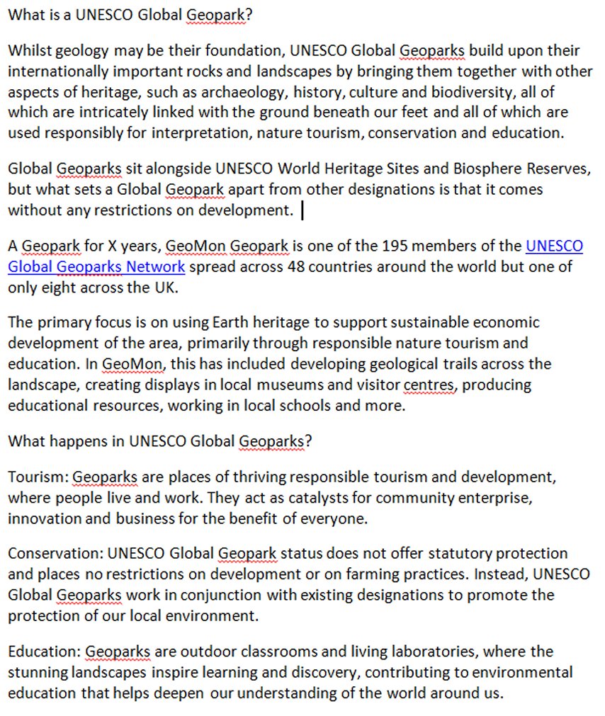
- Our coastal footpath, running around the entire island, will show you more than 100 rock types which have accumulated over 1,800 million years of earth history. You will be amazed at the variety of colours, textures, shapes and rock types that have created such beautiful landscapes. Don’t forget the wonders of the interior, Bodafon, Holyhead and Parys “mountains” each with their own particular geology and landscape. To help you explore, we have produced free trail leaflets for you to download and written several informative guidebooks for you to purchase from our ONLINE SHOP
- Please become a member to help us preserve this amazing geology & geoheritage and to help develop the local economy and to enjoy special benefits.
Please become a member to support our work